• 4 min read
Synthetic forests slash labels for tree-counting drones
Cambridge researchers use Unreal Engine forests to train drone AI, reducing real-world tree-labeling needs to just 2%–3%.
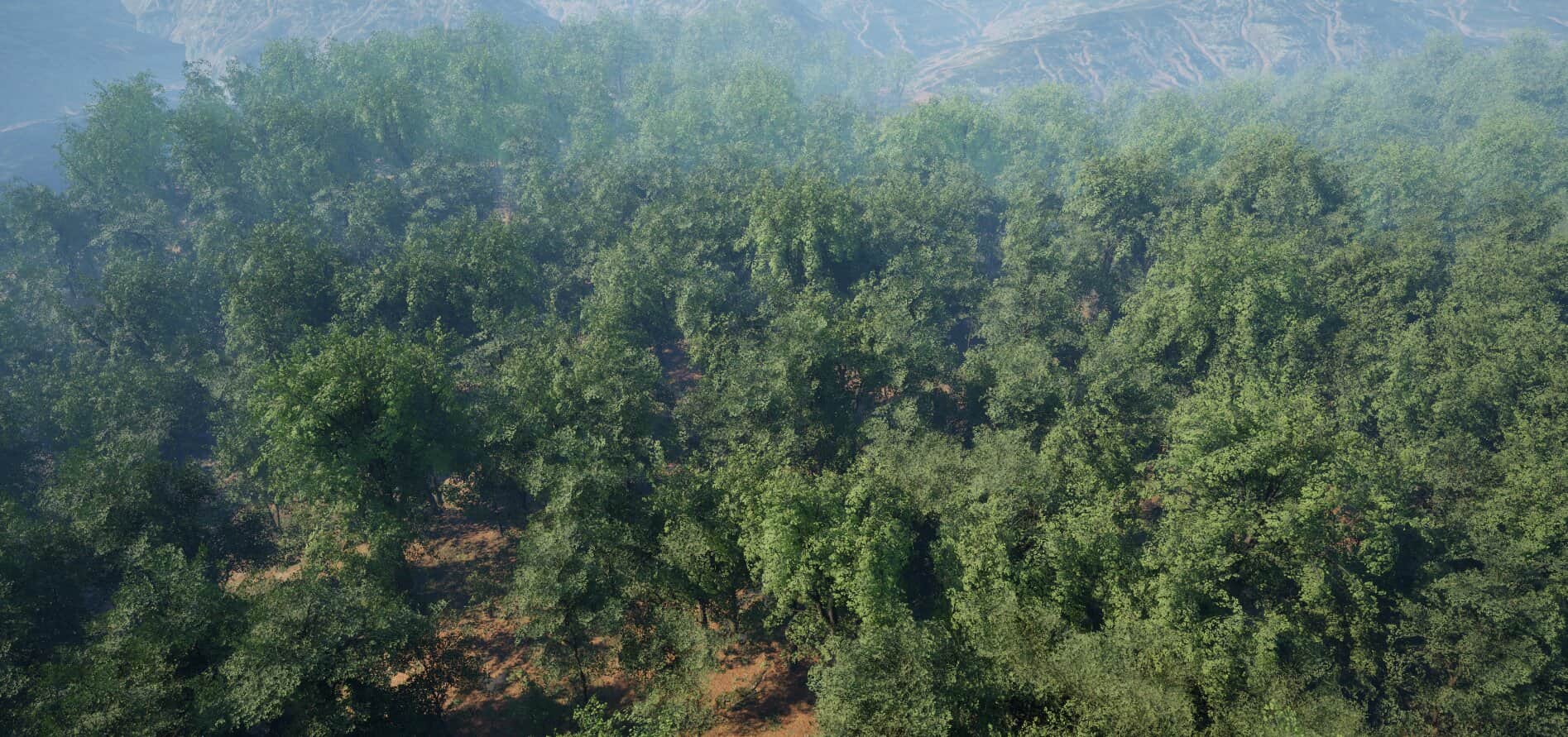
Image: TechXplore
A high-resolution forest scene rendered in Unreal Engine for the study. Credit: Yihang She
A forest-survey drone can now be trained to identify individual trees using a virtual environment, cutting the amount of real-world labeling required to 2%–3% of what traditional methods need.
Researchers at the University of Cambridge created the synthetic forest simulator as part of the doctoral work of Yihang She at the Department of Computer Science & Technology. The system generates realistic forest scenes, simulates drone flights and produces labeled lidar data automatically.

Recommended reading
Why scientific papers may poison LLM training
Identifying individual trees in forest canopies is essential for measuring forest growth, assessing responses to climate change and estimating carbon storage. Existing computer-vision systems typically require researchers to trace thousands of trees in survey data by hand, a process that can take weeks.
“In forest surveying, data collection itself isn’t the hard part; the hard part is cleaning and labeling that data. Without accurate individual-tree segmentation, none of the downstream work is possible. That’s where this study fits into the bigger picture.”
How the synthetic forest simulator works
The researchers used Unreal Engine’s procedural-generation tools to build virtual forests. They then flew a simulated drone through those environments with a simulated laser scanner, creating a virtual 3D point cloud similar to the data produced by a real lidar-equipped aircraft.
Because the simulator knows which points belong to each tree, leaf and piece of wood, the resulting point clouds are labeled from the start. The approach removes the manual segmentation step from synthetic data generation.
A drone’s view of a simulated forest generated using Unreal Engine. Credit: Yihang She
The resulting model still needs some real-world examples for fine-tuning. However, the study found that it required only 2%–3% of the labels used by conventional methods. In the comparison reported by the researchers, a model trained with simulated data performed as well as one trained on a fully labeled real-world dataset.
Samples of the synthetic training data represent leaves and wood by color, while another labeling view identifies individual trees. In the simulator, those labels are generated instantaneously.
From self-driving cars to forest ecology
She’s approach was inspired by the use of video-game technology in autonomous-vehicle development. While looking for real-world data for 3D forest reconstruction, he saw how self-driving-car manufacturers generate large numbers of simulated scenarios, including reckless driving and unexpected events.
A vegetation example from CARLA, a self-driving-car simulator also built on Unreal Engine, suggested that the same method could be applied to forests. The Cambridge team added HELIOS++, a physics-based laser simulator for forest surveys, and combined the components into the open-source Cambridge Arboreal Modelling Panoptic 3D, or CAMP3D, toolkit.
CAMP3D is freely available through the project’s GitHub page. The study and toolkit were published in the International Journal of Computer Vision.
Andrew Blake, professor emeritus of machine intelligence at the University of Cambridge and a co-supervisor of She’s Ph.D., said the technique could be reused in forest-ecology research. Blake was a pioneer of early computer vision research behind Microsoft’s Kinect and co-developed a foreground-background segmentation method still used in tools such as Word and PowerPoint.
“Yihang has done a beautiful piece of work here in vision simulation. It’s a wonderful modern tool for AI-driven research in forest ecology, and it should be widely reusable.”
Simulating satellite observations
After demonstrating the method with simulated laser mapping, the team replaced lidar with a more complex simulation of scattering electromagnetic waves. That allowed the researchers to render forests as they might appear to a passing satellite.
She said this could let the team investigate the internal workings of geospatial models, including Tessera, the University of Cambridge’s foundation model for satellite data.
“It opens up the possibility of designing controlled simulations to probe what geo-foundation models have learned about physical concepts.”
The researchers did not provide a release date or performance results for this satellite-simulation work. The published study is “Scaling Up Forest Vision with Synthetic Data,” by Yihang She and colleagues, in the International Journal of Computer Vision (2026), DOI: 10.1007/s11263-026-02923-y.
Swati Mestri. Credit: TechXplore
Swati Mestri holds a bachelor’s degree in Electronics Engineering and has worked as a content editor since 2019. She has edited research documents covering technology, health care and materials science, with a particular interest in technology and space.
Robert Egan. Credit: TechXplore
Robert Egan holds a bachelor’s degree in mathematical biology and a master’s degree in creative writing. He has traveled extensively and writes from perspectives shaped by science and language.
AI Editor
Ava covers the rapidly evolving world of artificial intelligence, from foundational models and research labs to the real-world economics of intelligence. With a background in computational linguistics, she cuts through the hype to find out what actually works. She firmly believes that benchmarks are just marketing until reproduced in the wild.
via TechXplore