NASA and IBM have taken an unusual step with their open geospatial AI model Prithvi: they put it in orbit. In a test led by researchers from the University of Adelaide, ESA, Thales Alenia Space, and SmartSat, the compressed model ran on two very different space platforms and quickly identified flood zones and cloud cover from Earth observation data. That makes Prithvi the first large model deployed directly in space, and it points to a future where satellites do more thinking before they send anything home.
The appeal is obvious. Satellites already generate huge volumes of raw imagery, but downlink capacity is limited, expensive, and painfully slow when a wildfire or flood is unfolding below. Processing data on board cuts the delay, trims bandwidth use, and gives operators faster answers instead of a data dump they have to sort out later.
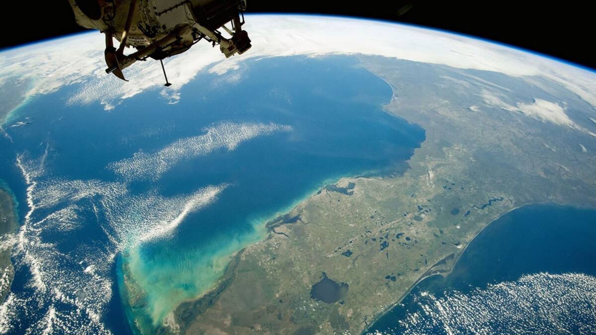
Prithvi runs on Kanyini and IMAGIN-e
For the experiment, the team loaded an optimized, compressed version of Prithvi onto South Australia’s Kanyini satellite and onto IMAGIN-e, a Thales Alenia Space test system mounted on the International Space Station. On both platforms, the model performed well at spotting floods and estimating cloud cover, which is exactly the kind of job where speed matters more than elegance.
Prithvi was an easy pick for another reason, too: it is open source and built to generalize across tasks. That matters because space systems have traditionally relied on narrow, lightweight AI models that do one thing decently and little else. A more flexible base model means operators can adapt a satellite to a new mission without rebuilding the whole stack.
Why open source matters in orbit
Andrew Du of the University of Adelaide said the team would have spent years building a foundation model from scratch if Prithvi had not already been available. NASA’s Kevin Murphy framed the result as proof that open science can speed up technical progress, and he is not wrong: in space AI, access often matters as much as raw performance.
Prithvi was developed by IBM and NASA’s IMPACT team at the Marshall Space Flight Center, and trained on harmonized Landsat and Sentinel-2 archives spanning a decade of Earth imagery. Its ground-based debut already showed up in a serious case: assessing the scale of the 2024 flood in Valencia. That is a useful reminder that orbital AI is not being built for sci-fi vanity projects; it is being built for triage.
What satellite AI can do with less bandwidth
The technical trick here is not just model size, but where the work happens. Instead of shipping every image to Earth first, satellites can run inference on board and send down only the useful results or a tiny update package if operators want to teach the system a new task. That is a cleaner answer to the bandwidth bottleneck than pretending every spacecraft has fiber internet.
- Model: Prithvi
- Developers: NASA and IBM
- Orbital test platforms: Kanyini and IMAGIN-e
- Tasks demonstrated: flood detection and cloud-cover analysis
- Data used for training: Landsat and Sentinel-2 archives
NASA now wants to keep going. After Prithvi and the 2025 heliophysics model Surya, the agency plans more open AI systems for planetology, astrophysics, and biology. The bigger question is whether space hardware will keep pace with these models, or whether the next bottleneck will be power, heat, and compute instead of bandwidth.